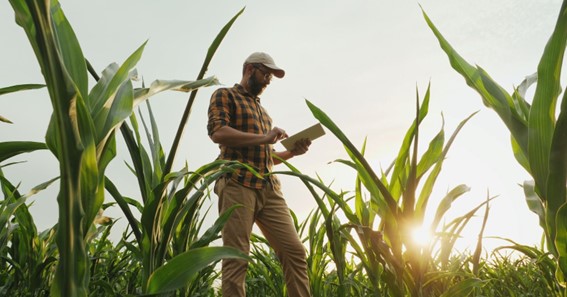
Agricultural production is one of the most risky areas of economic activity. The unpredictability of natural conditions and the variability of yield volumes are the main factors affecting the income level of agricultural producers. Sowing and growing crops entails significant financial costs for any agri company.
Luckily, agricultural technologies are constantly evolving, and it is important for insurance companies to be progressive and keep up with them. Providing customers with enhanced data about their fields is no longer a luxury but the expectation that insurance companies must use the most advanced technologies for risk management. For instance, satellite data can help grow the insurance business in three main ways: lowering operating costs, reducing risk exposure, and managing crop insurance claims with satellite-derived analytics.
click here – 5 Quick Tips For Better Automated Outbound Calls
Advantages of Precision Agriculture For Crop Insurance
Anything that improves efficiency and accuracy is worth the investment. For instance, modern satellite monitoring tools allow contouring a field as soon as it has been inspected on the ground by a specialist, and instantly provide users with data that is useful to confirm the farmland assessment. In the past, obtaining this type of data often required many days and personnel. Satellite imagery not only enhances the ability to determine agronomic variables, but also reduces the cost and time required to accurately quantify losses.
Instead of sending out scouts to inspect each area, satellite technology provides both historical and current data for specific locations. Instead of exploring a new field with a subjective judgment, you have access to years of quality historical field data. With this information, insurance companies can prioritize required field visits and streamline the insurance claims management process. This data also allows for quickly validating claims for damages with reliable information.
Satellite images provide an advanced level of information for planning and managing financial risks. Satellite technology enables insurance companies to receive almost daily updates on everything that happens in their clients’ fields, giving them the ability to monitor any critical weather conditions and properly manage financial resources for possible reimbursement. That is even in the conditions of cloudiness, since modern technology allows for detecting the cloud cover and still generate a useful satellite image. Also, the advantage of satellite imagery is that it can cover large areas in a short time and provide a complete view of the fields, which confirms specific decisions and actions.
For example, NDVI heterogeneity maps help confirm or deny the impact of a specific hazard, such as hail, chemical treatment of crops, flooding, pests and drought, which could affect the growth and development of a particular crop. Insurance companies can also use the data from these maps for further quantitative assessment obtained as a result of field analysis.
There are many factors that affect the development of vegetation and yield. However, the best information comes from the plants themselves, which can be counted as tens of thousands of sensors per hectare. Satellite images are used to obtain an accurate and objective view of the condition and potential of crops by analyzing information taken directly from the plants themselves.
click here – Top Blockchain Trends of 2022
Due to the heterogeneity inherent to crop growth, there will always be a level of inconsistency associated with physical inspection. However, the use of technologies, such as satellite imagery, can improve the accuracy of loss quantification. And accuracy is the key to success. Satellite technology helps to move forward with data you know to be objective and reliable, helping to build more accurate loss adjustment processes, reports, and insurance index models for the clients. Most importantly, satellite data can give insurance companies a better understanding of their activities and what is happening in their clients’ fields.
Gathering all of the necessary data on the ground would be nearly impossible. That is why a developing geospatial business and new monitoring and management software that allows for on-the-fly satellite imagery analytics is critical for insurance companies today. It not only enables better farmland inspection and assessment judgments, but also helps to identify any damage and crisis areas for performing rescue and recovery operations timely. Crop insurance companies can also benefit from land use classification for tracking land use changes and have a better understanding of related risks. All of this means balanced accuracy, claim’s need, and response speed for agri insurance companies.